Snowtography and Water
The importance of snow
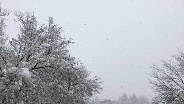
Snow in our forested mountain systems is the primary source of water for municipal, agricultural, recreational, and industrial water demands representing 75-90% of our water supply. Unfortunately, these systems are experiencing large changes due to shifts in temperature leading to larger wildfires and a decreased snowpack.
Snowtography: cutting edge with simple tools
Snowtography is a low-cost monitoring technique that allows us to understand how different forest structures and canopy cover impact snow accumulation, retention and ablation. An existing network of monitoring sites, called SNOTEL, already exists across the western US, but these sites are placed in open meadows at high elevations and do not represent the complexity of forest structures we see across the landscape.
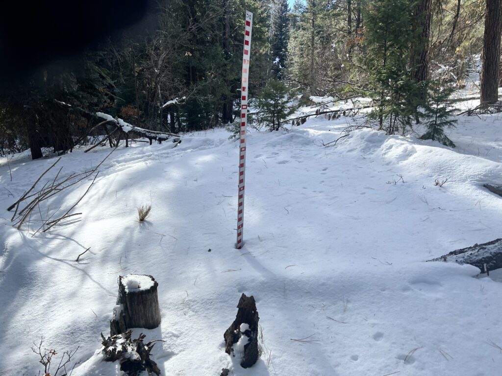
What sets snowtography apart is its simplicity and therefore ability to be implemented at multiple locations at a much lower cost than SNOTEL (about 50 times less expensive). Each snowtography site uses automated trail cameras that use time-lapse photography to observe snow stakes (a sort of measuring stick) on a transect (a line). After the season, operators go out to the cameras and download the images or cameras automatically upload their photos.
While SNOTEL is an irreplaceable resource for water resource managers, we hope to build a regional network of snowtography sites to not only understand our current water availability, but to also build an understanding of how forest structure, type, and location impact our water resources. The ultimate goal is to see if there is a possibility to increase water yields while reducing wildfire risk, but at a minimum, this effort will aid in improving our hydrologic modeling in these complex systems.
The Nature Conservancy alongside Wester Water Assessment developed the original handbook and piloted sites in Arizona and Southwest Colorado: Snowtography: Snowpack & Soil Moisture Monitoring Handbook in 2021.
“Accumulation, retention, and ablation, that’s all you need to know.”
Dr. Jake Kurzweil, Hydrologist at Mountain Studies Institute
Snowtography in the San Juan Mountains
Dr. Jake Kurzweil from Mountain Studies Institute and Dana Guinn from the Forest Stewards Guild (formerly with MSI and former Coordinator of SJHFHP) submitted a grant to expand the snowtography network in the San Juans with Joel Biederman from USDA as the principal investigator. Collaborators include the Center for Snow and Avalanche Studies, The Nature Conservancy, USDA, Western Water Assessment, Fort Lewis College, Mountain Studies Institute, Dolores Watersheds Collaborative and more.
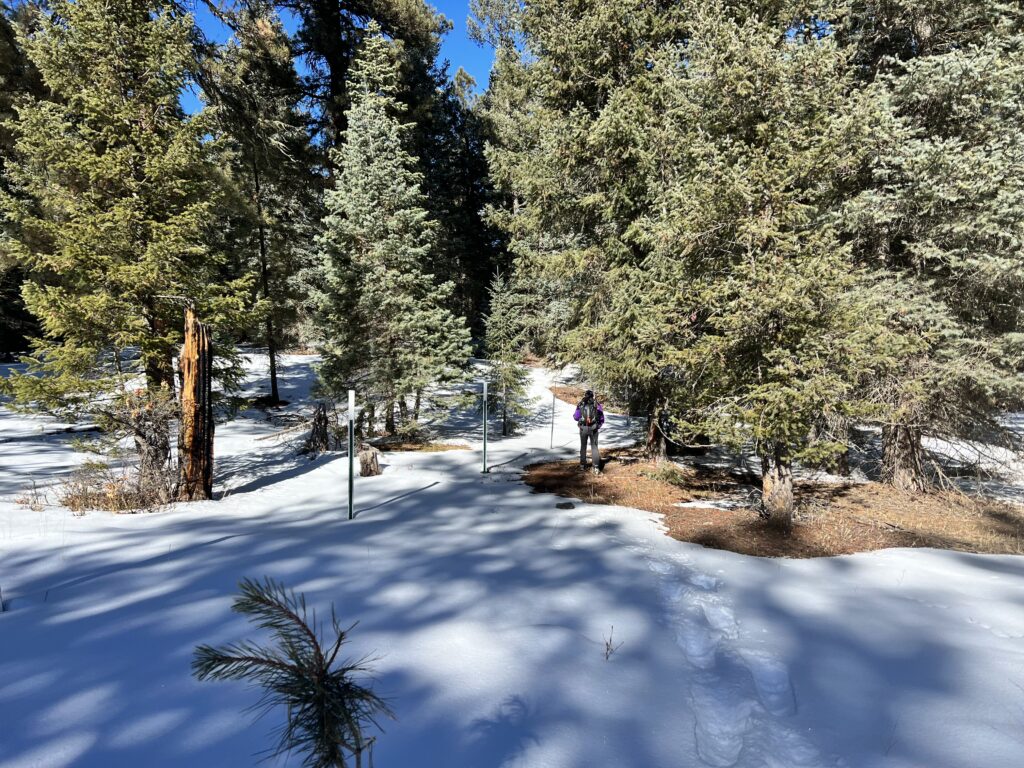
This summer, Headwaters partners and folks from Mountain Studies Institute went out to Jackson Mountain in the Adaptive Silviculture for Climate Change sites. A suitable site was found, and the installation took place in late September (look at the pictures below). Masters students along with a local team will carry out the monitoring, and inferences about the data can begin as early as 2 years after installation.
A special thanks to the Headwaters funders for supporting this project: San Juan Water Conservancy District and Pagosa Area Water and Sanitation District.
More information
- Read this article from the Durango Telegraph about local snowtography efforts.
- Read this academic article about previous snowtography research in Arizona.
“Snow knows. It’s telling us what’s happening out there. We just need to listen… with trail cameras.”
Dr. Jake Kurzweil, MSI
Watersheds
Articles and Research
East Troublesome Fire could cause water-quality impacts for years Article by writer Allen Best with Aspen Journalism. 2021
Linkages between forests, snowpack, and streamflow in western coniferous forests A Wildland Resources Department Seminar with Sara Goeking, US Forest Service scientist and USU PhD candidate. 2020
Forests and water: A state-of-the-art review for Colorado Lee H. MacDonald; John D. Stednick. 2003
The Case for an Open Water Balance: Re‐envisioning Network Design and Data Analysis for a Complex, Uncertain World Kampf, et al. 2020
Forest Management to Enhance Forest Resilience to Climate Change and Increase Water Supply in Colorado Kristen Leger, Conservation Leadership Graduate Program at Colorado State University
Forest Vegetation Change and Its Impacts on Soil Water Following 47 Years of Managed Wildfire Stevens, et al. 2020
Net change in forest density, 1873-2001. Using historical maps to monitor long-term forest trends Greg C. Liknes; Mark D. Nelson; Daniel J. Kaisershot. 2013
Managing Vegetation to Increase Flow in the Colorado River Basin Alden R. Hibbert. 1979
Hydroecological Models and Tools
RHESSys: Regional Hydro-Ecologic Simulation System—An Object-Oriented Approach to Spatially Distributed Modeling of Carbon, Water, and Nutrient CyclingTague, C. and Band, L.E. 2004
To find more articles about fire, scientific research, restoration, forest ecology, and more in our San Juan Headwaters website, click HERE.